Apart from the marathon (well, 24 km) hike around the Lac de Joux 2 weeks ago, this was my first GIN hike for 8 months, mainly due to open-heart surgery during the summer. So it was with some apprehension that I offered to organise a mountain hike in the French Alps to the east of Annecy. I felt sure that the ascents were going to slow me down, so I made sure that I went in front on the narrow tracks so that none of the greyhounds on my heels could streak ahead.
However, problems arose before we even reached the hike start. After passing through Thorens-Glière, Usillon and the hamlet of Nant-Sec, we came across a “road-blocked” sign. Since there was no deviation possibility, we optimistically drove straight on. A kilometer further was a second road-blocked sign, which looked a bit more serious. Since this was only some 700 m short of our intended stopping point, we found a verge-side parking spot for the three cars and set off on foot up the road. The reason for the signs quickly became apparent – trees were being felled just above the road and one of the lumberjacks advised us that if we continued we would face hefty fines.
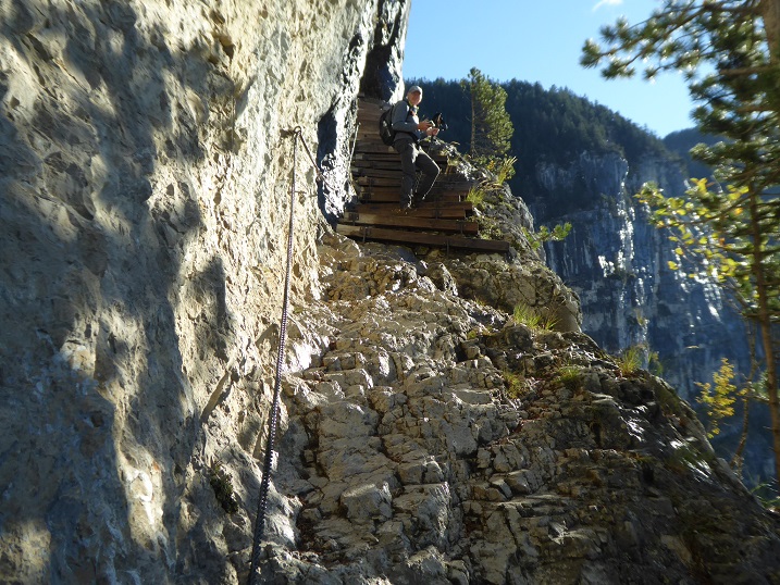
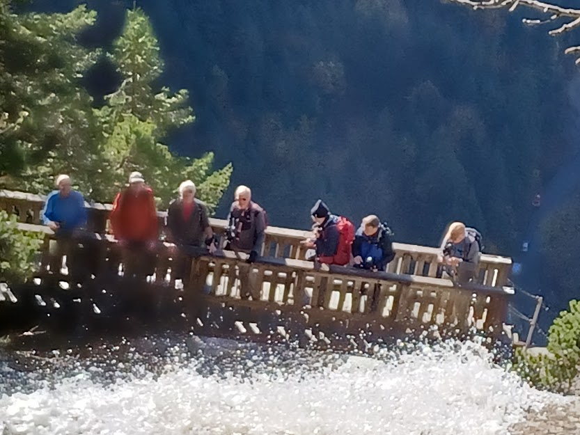
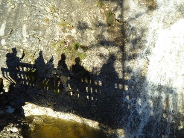
Undeterred, the eight of us – Mark 2tts, Mark 2rrs, Richard, Andrew, Nathan, Mervyn, David and me, Philip – set off up the narrow path crossing the slope above us while keeping a close look-out for falling trees. The path zigzagged up the slope at a pleasant gradient and after 1 hour we reached a steeper, more rocky section – the Pas du Roc. Here the path had been cut out of the cliff, which reared hundreds of meters above our heads. On the outer side of the 2m-wide path the cliff plunged vertically to the forest below. The recent rain made some sections of the path quite slippery, and one slip here could have proved fatal. Fortunately, hand holds had been provided, in the form of cables and chains, to avoid touching the void.
The explanation for the human engineering of this bold path is that in 1830 it was decided to build a glass factory on the plateau above. The high-quality glass was to be made from Salève sand, but also needed substantial quantities of wood to fuel the fires. The cliff-carved path was the only way of bringing in the timber, presumably on horses or mules. In fact the glass factory only operated until 1860.
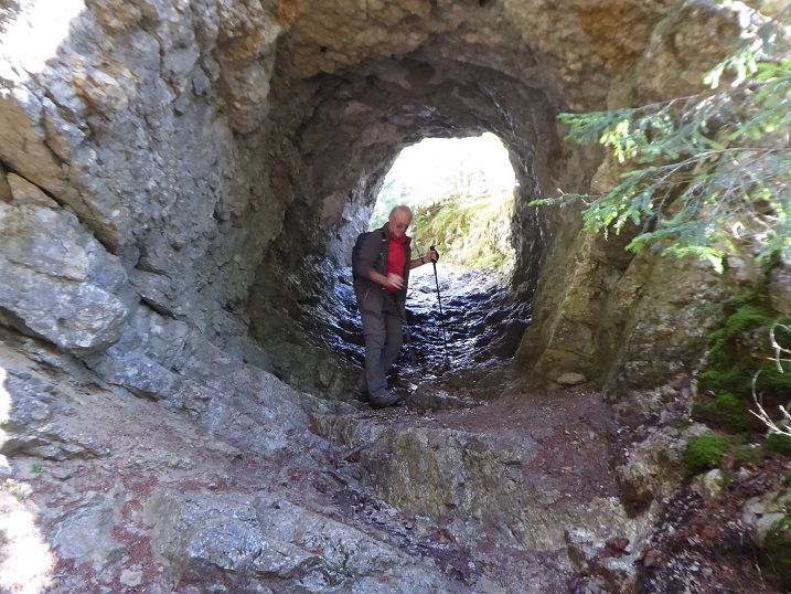
Above the delicate passage was a cascade, swollen by the recent rains and crossed by two bridges. Richard nobly climbed up to the higher bridge to photograph us on the lower one. From here the path wandered across the Champ Laitier, a huge plateau of boggy ground.
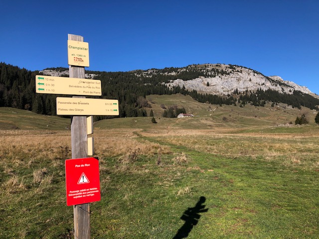
It was around this point that an interesting discussion arose concerning the whereabouts of a mountain called the Sous-Dine. I told the group that the mountain over to the left must, from its profile, be the Sous-Dine, a mountain that Richard and I had climbed a few years earlier. Richard replied that it was impossible, as a sign that he had just spotted announced the Sous-Dine by pointing to the right. To the right there was indeed a mountain but it was forested to the summit, which the Sous-Dune is not. I pondered for a moment then brought out my trump card: “my IGN 1:25000 map indicates that the Sous-Dine is to the west of our present position. Unless my compass has inverted, west is over to the left, whereas that sign is pointing eastwards.” Faced with this irrefutable logic, Richard graciously admitted defeat. We could only explain this strange situation by assuming that either the sign had been erected the wrong way round or, more likely, that it wanted hikers to take a “scenic deviation” across the boggy ground.
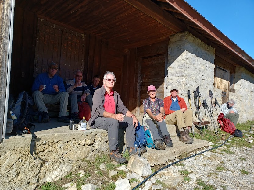
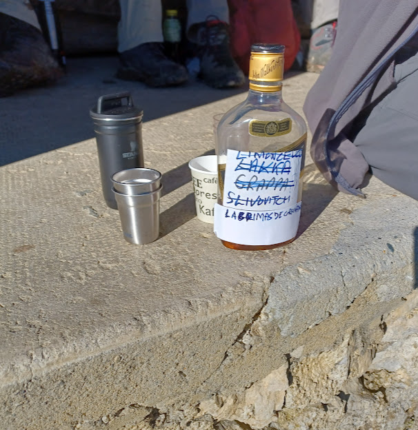
Up ahead was a large building, the Chalet de Plan, which looked as though it would be a good picnic spot since it was now well past midday. It proved to be the perfect place, with steps and a bench to sit on in the warm sunshine. The blog writer notes that GIN outing accounts traditionally mention conversation items covered during lunchtime. Given the erudite nature of the group members, it is no surprise that the conversation between bites covered such learned topics as 1) the relative merits of cooking techniques for eggs – hard boiled, soft boiled, sunny side up or easy over; 2) the resignation of a bullying UK cabinet minister; 3) the quality of the alcoholic beverage that Richard brought, which allowed us to toast absent friends. Scottish independence was deemed not to be a worthy topic as there was nobody present to defend it. We probably need an eloquent Scot to revitalise this once-popular topic.
Having eaten well, we decided not to continue further over the Champ Laitier but to head downwards via a deviation across boggy ground sloping down to the river that fed the cascade. Since we were well equipped with torches and head lamps, we fixed as objective a goufre (pothole) marked on the 1:25000 map. With Nathan keeping a constant eye on his GPS, we soon came across what might have been a pothole. There was certainly a depression in the ground, surrounded by a feeble fence that would have posed no problem to a determined warthog. However, the height of the nettles around the hole was enough for even the most enthusiastic cavers among us to be put off any further investigation.
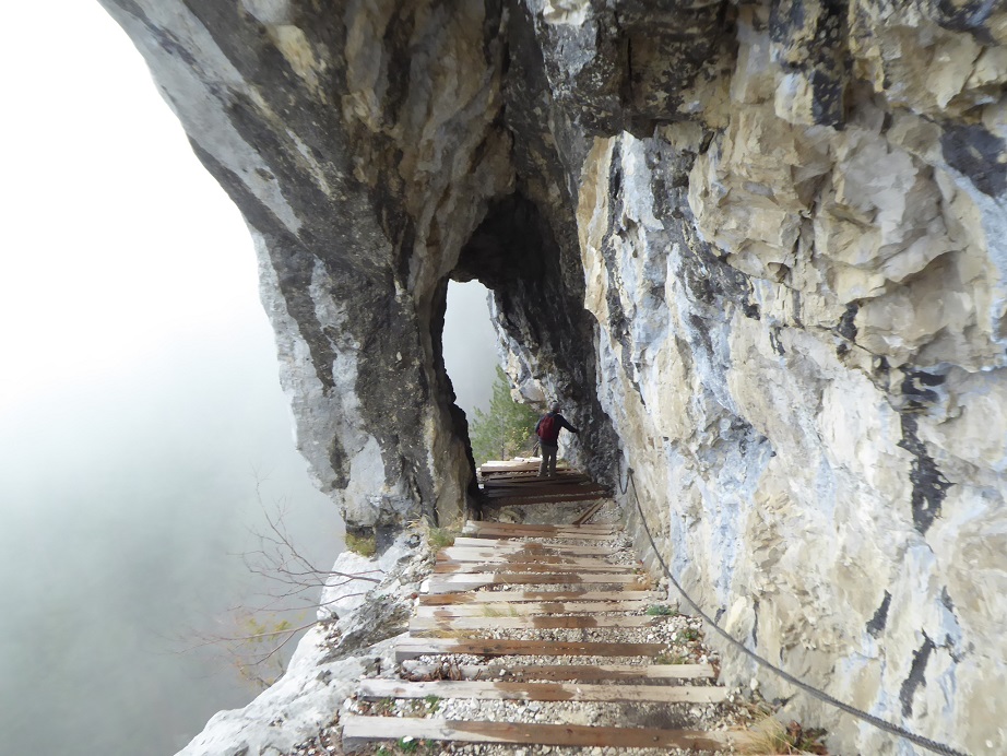
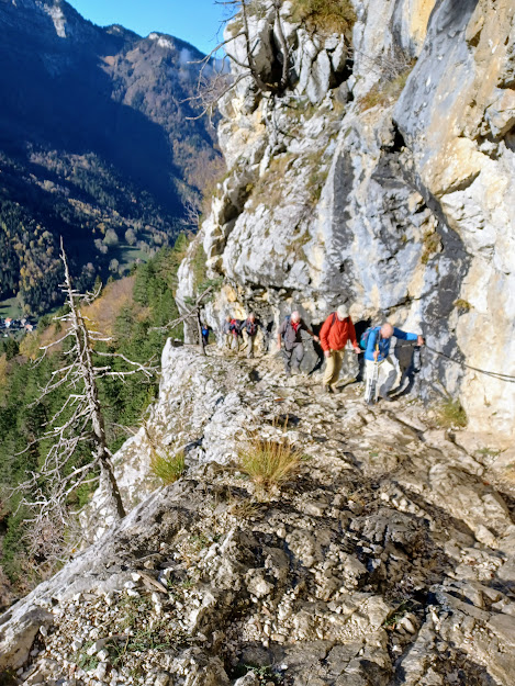
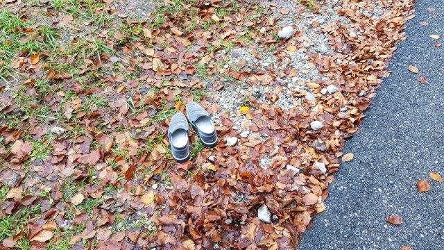
As we descended, the pleasant sunshine gave way to thick mist, which provided a suitable atmosphere to the 200m-long delicate cliff-cut path. No one spoke. It definitely needed 100% concentration to avoid a dangerous slip. Once past this hazard, we could relax and enjoy the contrasting autumnal colours of the beeches, oaks and conifers. Back at the cars we discovered David’s pair of clean shoes lying undisturbed on the ground outside the car where they had been all day!
In the Thorens-Glière bistro where we stopped for a well-earned drink, it was generally agreed that the Pas du Roc hike provided an interesting variation to the more usual Jura walks. Now, while we await the first snows that will allow us to get moving on raquettes, there might just be time for one more autumnal hike.
An excellent day out and an excellent account of it.
Great to have you back in the fold, Philip.